I wanted to ride the first part of the Seoul 300K brevet to familiarize myself with the route, so I was up before the sun, fed and riding down the Jungnang Creek bike path quite quickly. It’s been a cold start to the year, and the morning air was still quite cold. I ride that path to work regularly, so it was a little disconcerting to be riding that path on a Sunday, on a recreational ride, with a regular commuting podcast playing.
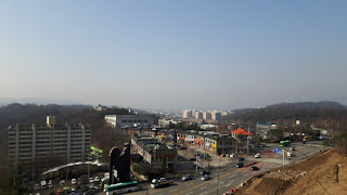
I arrived at the Yangjae turnoff on the Tancheon creek and almost went right, out of commuting instinct. I carried on toward Bundang, however, and found the correct U-turn, stopping to take a photo and note the surroundings, as it is specifically mentioned as a navigation hazard in the route information.

I suspect there’s a story behind that mention.
I rode further and promptly got snarled up in a mess of construction, as my GPS track was saying one thing, while my surroundings were saying another. I circled around until I found an acceptable detour, making a note to send some info to Korea Randonneurs to keep others from getting enmeshed in apartment construction hell.
Past the new housing developments is the road toward Namhansanseong. I know the area of old, as I used to go mountain biking there many moons ago and I have ridden up the road to Sanseongri, the little village on the mountain, before, so I was not unaware of the climb that faced me. In the event, it wasn’t too bad, my memory had made it out to be much steeper than it actually is.


I was joined by a foreign guy about three-quarters of the way up, and we spoke a little about randonneuring in Korea. Having pulled through the tunnel, he stopped to wait for his mate and I pulled down the road a little way to a pagoda to get some electrolytes into me and change my Buff helmet liner. The foreign guy—another Mark—pulled past with his friend, and I followed them a few minutes later, reacquainting myself with the longer, more gradual grade on that side of the high ground, headed down to Road 43. I found the turn onto Road 45 easily and pulled up the following hill, seeing the first of the road cyclists and Harley Davidson Riders that would be a constant presence throughout the ride. Who knew that so many Koreans rode Harleys?

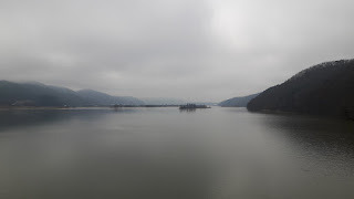
The bridge over the Gyeong Ahn River followed, with many of the hills still cloaked in mist.
I stopped for a drink at Korea’s nastiest service station. Many of the shelves in the “mart” section were bare, and when I opened the fridge it smelled like it was turned off. After opening warm bottles of water, I realized I was right. A visit to one of the worst toilets in Korea later, I was eager to leave the shabby little place behind. If ever you are tempted to stop at the SK service station on that small road to the south, just after Twei Cheon, don’t.
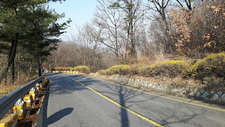
Up the road a little way I rode a hill, which was quite deceptive. I didn’t have an elevation profile active on the map on my phone, and it had the look of a much bigger climb. I stopped to take a few photos before a turn to the left.


Rounding the bend, I actually laughed out loud, as the summit was right there ahead.
I descended into a river valley and was expecting farms bustling with spring activity and cloaked with the smell of smoke and manure that is so common in Gyeonggido at this time of year. What I saw instead, was a lot of nice modern coffee shops, bakeries and trendy antiques/bric-a-brac stores with cool statues and old things spilling out into their yards. One place even had a Model T Ford, as well as a Morris 8 Tourer, a pre-war British car.
I was suddenly surrounded by roadie cyclists, having to calm myself down after being passed way too closely by Korea’s rudest, most aggressive paceline. I told myself it wasn't worth the argument, and it wasn’t, because I was soon off the roadie route, getting a taste of a road that is a real treat for cyclists, with small rolling hills and pretty surroundings. You really have to work up some of the small climbs, and I look forward to riding it again; it’s something different from my usual fare in Korea. Jan Heine, the randonneuring editor of Bicycle Quarterly and owner of Compass Cycles, “collects” roads and I smiled at myself, thinking that I had just added one to my personal collection.
“The Climb” was upon me then. By no means the highest of the day—it’s only 80 meters of elevation gain from the turn—it was certainly the worst for me. Something about the steepness of it, or some other intangible thing made it an excruciating little ride. I got up it, though, and had a well-earned drink at the top, downing about a liter of electrolyte-filled liquid and wanting more.
It’s strange how, in cycling, an otherwise insignificant hill can become a small personal hell, while a much bigger climb elsewhere can be ridden with a song in the heart and a smile on the lips.


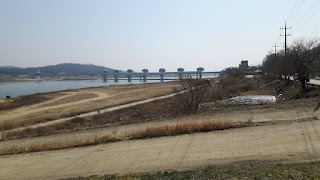
I had lunch then, and rested my legs. I left the brevet course at that point and rode down the Nam Han Gang, the Southern Han River, toward Asin station, to pick up the brevet course again and to make it home in the early evening.
The crowds were not too bad and that part of the bike path was previously unknown to me, but it was a slight let down to come down out of the climbs in the hills to the more sedate Seoul-Busan cycle path. I passed through Yangpyeong, remembering a large bike ride I had ridden in to that point of the bike path a few years ago, an event celebrating the coming Pyeong Chang Winter Olympics.
I arrived at the bike path near Asin station and got back on course, turning off to the north to recon the road coming down from Road 37, forming part of the brevet route. The mountain further up that road is the final climb on the 300km brevet, rising to 500 meters or so, and I wanted to see the final turn off to Asin from Road 37 and to make the turn onto the bike path back into Seoul, knowing that the next time I do those things I will be utterly exhausted and happy to see familiar surroundings. I stopped at the 7-Eleven control at Asin for a drink and then was off again, riding out to Yangsu Station and across the bridge over the Buk Han Gang, the Northern Han River in heavy bike traffic.
I had planned to take bike paths back to Guri and then pop up the river to ride home via Byeollae, but I ended up headed north up the Buk Han Gang to the Gyeongcheon Line path with a dead phone. I gave it some juice from my battery bank as soon as I realized, but the GPS track has a strange straight line in it. The ride along the Gyeongcheon Line path was uneventful; it has come to be one of the routes I ride when I’m going somewhere else, like into the hills in Yangpyeong. It’s predictable, and as it’s an old railway route, the grades are always gradual.
I pulled up through Byeollae and over the flank of Suraksan, riding down to familiar old Road 43, past the US Military base and the prison, finally climbing the final small hill of the day toward home where I saw the sun setting over Sapaesan.

It was a good ride and I gained a lot of valuable intel on the ride to come. It's going to be a massive challenge for me, but I’m looking forward to it.